
Discover how a security common operating picture enhances real-time situational awareness, streamlines responses, and improves multi-agency collaboration.

Security Common Operating Picture: A Practitioner's Guide

A security common operating picture (COP) is a continuously updated, shared display of incident-relevant information compiled from integrated communication, information management, and intelligence systems to deliver real-time situational awareness across all incident management levels and jurisdictions.
- Data fusion at the core. A COP ingests and normalizes feeds from sensors, CAD/911, weather, satellite, and IoT systems into a single, coherent operational view, separating actionable intelligence from raw data noise.
- Built for every tier of government. Federal agencies, state emergency operations centers, local public safety dispatch, tribal authorities, and fusion centers all operate within or contribute to a COP framework.
- Tactical and strategic value. A well-governed COP compresses decision cycles, aligns multi-agency response, and gives commanders the shared ground truth needed to coordinate resources before conditions change.
Key Takeaways
A security common operating picture delivers coordinated situational awareness only when data fusion, governance, human validation workflows, and role-based access are all present and actively maintained.
| Point | Details |
|---|---|
| COP vs. situational understanding | A COP displays facts; shared understanding requires structured sense-making and collaborative interpretation processes. |
| Governance is non-negotiable | Designate a program authority, assign data stewards per agency, and execute MOUs before onboarding any data source. |
| Sensor first-mile quality | Time-sync, telemetry health checks, and metadata standards at commissioning prevent data quality failures from propagating through the fusion layer. |
| Phased implementation | A pilot covering two to four data sources with defined success criteria is the lowest-risk path to an operationally trusted COP. |
| Beyondsensor's role | Beyondsensor provides sensor hardware, AI-powered dashboards, and integration services that connect the sensor first mile to agency COP architectures. |
Table of Contents
- What is a security common operating picture, and how does it differ from related terms?
- What core components does every COP require?
- Who uses a COP, and what does it look like in practice?
- What data sources feed a COP, and how should you prioritize integration?
- How should you architect a COP for interoperability?
- How do you govern a COP and protect privacy?
- How do you build a COP? A phased roadmap
- What are the most common COP implementation pitfalls?
- How does the DHS COP and National Operations Center work?
- Sensor integration best practices for COP readiness
- The honest limits of a common operating picture
- Beyondsensor supports your COP program from sensor to dashboard
- Sources
What is a security common operating picture, and how does it differ from related terms?
The term "common operating picture" gets used loosely, and that imprecision costs programs real money. A COP is a single identical display of relevant operational information shared by more than one command to support collaborative planning and execution. That definition is neutral on technology; it describes a function, not a platform.
Three adjacent terms create the most confusion:
- Common Tactical Picture (CTP). A CTP is narrower in scope, typically covering a single operational domain (air, maritime, or ground) at the tactical level. A COP aggregates across domains and scales to strategic command.
- Common Situational Understanding (CSU). This is where most programs fall short. Peer-reviewed practitioner analysis is direct on the point: a COP is a display of facts; situational understanding is the interpreted mental model produced by human coordination and sense-making. You can have a perfect COP and still lack shared understanding if no collaborative interpretation process exists.
- Single pane of glass. A single-pane-of-glass interface consolidates multiple data views into one UI. It is a presentation pattern, not a doctrine. A COP can be delivered through a single-pane interface, but the COP concept encompasses governance, data fusion, and workflow, not just the screen.
JESIP doctrine offers a practical content framework: build your COP by answering three questions in sequence.
Authoritative U.S. references include the DHS Common Operating Picture program, the DHS National Operations Center (NOC), and ArcGIS Enterprise from Esri, which serves as the GIS backbone for federal COP replication.
What core components does every COP require?
A COP is not a single product. It is an architecture of technical layers and human workflows. Strip out any one of the following and the picture degrades.
- Data ingestion and connectors. APIs, message queues, and protocol adapters that pull feeds from CAD, sensors, databases, and external services into the platform.
- Information fusion and normalization. The layer that standardizes formats, resolves duplicate records, validates provenance, and aligns geo-temporal references before data reaches any dashboard.
- GIS mapping and situational awareness dashboard. The visual layer where fused data becomes a map-based operational picture. ArcGIS Enterprise is the dominant platform for this function in U.S. federal and state programs.
- Incident management linkage. Integration with incident management systems (IMS) so that COP displays reflect live incident status, resource assignments, and operational periods.
- Communications and collaboration tools. Secure messaging, voice bridges, and shared annotation tools that let operators act on what the COP shows without switching platforms.
- Analytics and rules engines. Automated alerting, threshold triggers, and pattern detection that surface anomalies so operators focus on exceptions rather than monitoring every feed manually.
- Audit logging and resiliency. Immutable logs for accountability and after-action review, plus redundant architecture to keep the picture alive during degraded conditions.
- Human validation workflows. Operators who confirm data accuracy, flag stale feeds, and escalate anomalies. Practitioners consistently find that skipping this human layer turns a COP into a distrusted display within weeks of go-live.
| Component | Primary function | Key design consideration |
|---|---|---|
| Data ingestion and connectors | Pull multi-source feeds into the platform | Protocol diversity; handle REST, MQTT, and legacy serial feeds |
| Information fusion layer | Normalize, deduplicate, and validate data | Canonical data model; geo-temporal alignment |
| GIS mapping and dashboard | Visualize fused data on a shared map | Role-based views; mobile rendering |
| Incident management linkage | Sync live incident status and resources | Bidirectional write-back to IMS |
| Analytics and rules engine | Detect anomalies and trigger alerts | Threshold tuning to reduce alert fatigue |
| Audit logging | Support accountability and after-action review | Tamper-evident, timestamped records |
| Human validation workflow | Confirm data quality and escalate issues | Defined SOPs; shift handoff procedures |
Who uses a COP, and what does it look like in practice?
The user base spans every tier of the response community.
- NOC and operations center staff who maintain the strategic picture and brief senior leadership.
- Incident commanders who need a shared ground truth to coordinate multi-agency field resources.
- Public safety dispatch and fusion center analysts who correlate incoming reports against the live picture.
- Emergency planners and logistics coordinators who use the COP for resource pre-positioning and mutual aid requests.
- System integrators and platform engineers who build, maintain, and extend COP infrastructure.
Five use cases show where a COP changes outcomes:
- Large natural disaster. During a hurricane response, a state EOC COP fuses National Weather Service feeds, shelter occupancy data, road closure reports, and utility outage maps. Incident commanders see resource gaps in real time rather than learning about them at the next briefing cycle.
- Multi-jurisdiction protest or civil unrest. A regional COP shared across city, county, and state law enforcement aligns resource deployment and prevents duplicated or conflicting orders across agency boundaries.
- Transportation corridor incident. A highway or rail incident COP integrates traffic management center feeds, first-responder CAD data, and hazmat databases to give unified command a complete picture of the affected corridor.
- Critical infrastructure outage. During a power grid event, a COP correlating utility SCADA alerts, 911 call density, and hospital backup-power status lets emergency managers prioritize restoration sequencing.
- Airspace and air operations coordination. NUAIR's analysis makes the case that public safety now requires a dedicated air-focused COP layer to coordinate crewed aircraft and unmanned aerial systems around active incidents, preventing airspace conflicts that can ground medical helicopters.
Remote and field access matters as much as the ops center display. Mobile-first COP clients with offline caching and low-bandwidth modes are no longer optional for field commanders operating in degraded network environments.
What data sources feed a COP, and how should you prioritize integration?
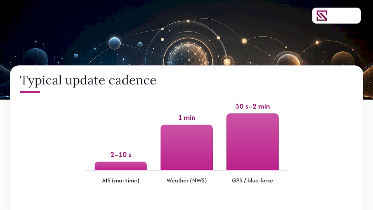
| Data source | Operational value | Typical update cadence | Integration complexity |
|---|---|---|---|
| CAD / 911 systems | Live incident status and unit dispatch | Near real-time (seconds) | Medium — proprietary APIs vary by vendor |
| IoT sensors and physical security systems | Perimeter alerts, access events, environmental readings | Seconds to minutes | Medium to high — protocol diversity |
| Weather services (NWS) | Forecast impacts, severe weather triggers | 1 minute | Low — standardized feeds available |
| Satellite and aerial imagery | Damage assessment, large-area situational awareness | Minutes to hours | High — large file sizes, processing overhead |
| AIS (maritime tracking) | Vessel position and identification | 2–10 seconds | Low — NMEA/AIS standards well-established |
| Social media and open-source intelligence | Early warning, public sentiment, unconfirmed reports | Continuous | High — noise filtering and validation required |
| Utility and SCADA systems | Infrastructure status, outage extent | Minutes | High — legacy protocols, security constraints |
| Satellite-based GPS and blue-force tracking | Field resource location | 30 seconds to 2 minutes | Low to medium |
Integration priorities follow a clear logic. Data quality and provenance come first: a feed that arrives fast but carries unvalidated data degrades the COP faster than no feed at all. Update cadence must match operational tempo; a maritime COP needs AIS at seconds, while a logistics COP can tolerate five-minute resource location updates. Format normalization, specifically aligning coordinate systems, timestamps, and identifier schemas, is the most underestimated labor cost in any integration project.
Pro Tip: Before onboarding any new data source, define its validation workflow first. Who confirms the feed is live? Who flags stale data? A feed with no owner becomes a liability the moment it silently fails.
How should you architect a COP for interoperability?
Two primary architecture patterns exist, and most real-world deployments land somewhere between them.
Centralized architecture routes all data to a single platform where fusion, analytics, and presentation occur. It offers tight control, consistent data quality, and simpler governance. The trade-off is latency for geographically distributed contributors and a single point of failure if resiliency is not engineered in.
Federated architecture keeps data at the source and exposes it through standardized APIs or a shared data fabric. Each agency retains sovereignty over its data while contributing a normalized view to the shared picture. Latency and data quality consistency are harder to guarantee, but the model scales better across jurisdictions with competing authorities.
Core integration layers for either pattern:
- Ingestion connectors. Adapters for REST, MQTT, SOAP, FTP, and legacy serial protocols.
- Message bus or event streaming. A publish-subscribe backbone (Apache Kafka is common in enterprise deployments) that decouples producers from consumers and buffers high-velocity feeds.
- Canonical data model. A shared schema that all normalized data conforms to before reaching the analytics or presentation layer. NIEM (National Information Exchange Model) is the U.S. government standard for this function.
- Analytics layer. Rules engines, spatial analytics, and machine learning models that operate on normalized data to generate alerts and derived products.
- Presentation layer. Role-based dashboards and GIS maps. ArcGIS Enterprise from Esri is the most widely deployed platform for GIS-enabled COPs in U.S. federal and state programs, supporting both centralized and federated replication models.
- Role-based access control (RBAC). Enforces least-privilege access so field operators see their operational view while analysts and commanders see broader aggregated layers.
The U.S. Department of Defense's Joint All-Domain Command and Control (JADC2) strategy frames multi-domain information fusion and shared command-and-control data layers as foundational requirements at the strategic scale. The same principles apply to enterprise COP implementations that cross agency and jurisdictional boundaries.
Pro Tip: Design your canonical data model before you write a single API connector. Retrofitting a schema onto 12 already-integrated feeds is one of the most expensive mistakes a COP program can make.
How do you govern a COP and protect privacy?
Governance is where most COP programs underinvest, and it shows up as data disputes, access conflicts, and stalled deployments.
Governance checklist:
- Designate a COP program authority with clear decision rights over data standards, access tiers, and change management.
- Assign data stewards for each contributing agency who own feed quality, update schedules, and incident response for their data stream.
- Define SLAs for feed availability, latency, and data quality, with escalation paths when SLAs are breached.
- Establish audit trail requirements: who accessed what, when, and what actions they took.
- Document decision rights across agencies for adding, modifying, or removing data feeds.
Access control approach:
- Implement RBAC with at least three tiers: operational view (field and dispatch), analytical view (planners and analysts), and administrative view (platform engineers and data stewards).
- Apply least-privilege principles: no role sees data beyond what its operational function requires.
- Separate PII-containing feeds (e.g., victim data, law enforcement records) into restricted layers with additional authentication requirements.
- Enforce session logging and automatic timeout for all privileged roles.
- Review access grants quarterly and immediately upon personnel changes.
Legal and privacy considerations for U.S. deployments:
- Federal data-sharing is governed by a patchwork of statutes. Identify the applicable authorities (Privacy Act, E-Government Act, relevant agency-specific statutes) before onboarding any personally identifiable information.
- Law enforcement data feeds may trigger Criminal Justice Information Services (CJIS) Security Policy requirements, including encryption, audit logging, and personnel screening for anyone with access.
- Interagency data sharing requires executed Memoranda of Understanding (MOUs) or data-sharing agreements that specify permitted uses, retention limits, and breach notification obligations.
- FEMA's NIMS framework provides the incident management and interoperability baseline that COP governance structures should align with across federal, state, and local levels.
How do you build a COP? A phased roadmap
Phase 1: Plan and define requirements (months 1–3)
- Identify the operational problem the COP must solve and the primary user roles it serves.
- Inventory existing data sources, systems, and integration points.
- Define governance structure, data stewards, and decision rights.
- Draft data-sharing agreements and MOUs with contributing agencies.
- Select architecture pattern (centralized vs. federated) based on latency, sovereignty, and resource constraints.
Success criteria: Approved requirements document, signed MOUs, and a named program authority.
Phase 2: Pilot and proof of concept (months 4–9)
- Onboard two to four high-priority data sources (typically CAD/911, weather, and one sensor feed).
- Stand up GIS mapping and dashboard for a defined operational area.
- Run tabletop exercises and live drills to validate the picture against real incidents.
- Collect operator feedback on display design, alert thresholds, and workflow gaps.
- Conduct a security and privacy review of all integrated feeds.
Success criteria: Operators trust the picture for at least 80% of incident types in scope; no unresolved data quality incidents older than 48 hours.
Phase 3: Operationalize (months 10–18)
- Expand data source onboarding per the prioritized integration backlog.
- Implement full RBAC, audit logging, and resiliency architecture.
- Deliver role-specific training for all user tiers.
- Establish SOPs for feed validation, alert response, and shift handoff.
- Integrate with incident management systems for bidirectional data flow.
Success criteria: COP is the authoritative operational picture for all in-scope incident types; training completion documented for all roles.
Phase 4: Scale and continuous improvement (month 19 onward)
- Expand geographic coverage and add contributing agencies.
- Introduce advanced analytics, predictive alerting, and automated workflows.
- Conduct quarterly data quality reviews and annual governance audits.
- Measure COP effectiveness against defined KPIs (see Performance Measurement below).
Typical cost drivers:
- Data licensing fees for commercial feeds (satellite imagery, weather, AIS)
- Integration labor for custom connectors and legacy system adapters
- Hosting and compute costs for the fusion and analytics layers
- Sensor hardware procurement and installation
- Training development and delivery across multiple agencies
- Sustainment: platform licensing, feed maintenance, and ongoing staff time
What are the most common COP implementation pitfalls?
Even well-funded programs fail predictably. These are the pitfalls that appear most often, paired with direct mitigations.
- Stale or silently failing feeds. A feed that stops updating without alerting operators is worse than no feed. Mitigation: Implement automated feed health monitoring with alerts when a source exceeds its expected update interval.
- Overloaded dashboards. Displaying every available data layer simultaneously creates visual noise that operators learn to ignore. Mitigation: Design role-specific views with default layers tuned to each role's operational tempo; let users toggle additional layers on demand.
- No validation workflow. Data that flows directly from source to display without human or automated validation produces a picture operators stop trusting. Mitigation: Assign data stewards and define explicit validation SOPs before go-live.
- Treating the COP as a substitute for situational understanding. Practitioner research is clear: a COP displays facts; understanding requires coordinated interpretation. Programs that invest only in the display and skip collaborative sense-making processes consistently report that operators "see the same picture but reach different conclusions." Mitigation: Build structured briefing cycles and shared annotation workflows into the operating model.
- Interoperability assumed, not tested. Agencies often discover incompatible coordinate systems, timestamp formats, or identifier schemas only after integration is "complete." Mitigation: Run end-to-end data flow tests with real production data, not synthetic test records, during the pilot phase.
- Governance gaps at agency boundaries. When no single authority owns cross-agency data disputes, feeds get disabled rather than fixed. Mitigation: Establish a cross-agency COP governance board with documented escalation paths before the first data source goes live.
Pro Tip: Run a "broken feed" drill during your pilot phase. Deliberately disable one data source without telling operators and measure how long it takes them to detect and report the gap. The answer will tell you more about your validation workflow than any checklist.
How does the DHS COP and National Operations Center work?
The DHS Common Operating Picture program is the most instructive national-scale example available to U.S. practitioners. The DHS COP provides strategic-level situational awareness by collecting and fusing multi-dimensional information from across the Homeland Security Enterprise, then replicating incident data into an ArcGIS Enterprise platform to visualize and support prevention, protection, mitigation, response, and recovery missions.

The National Operations Center (NOC) serves as the operational hub: it maintains the national COP, coordinates information sharing across federal departments and agencies, and provides the authoritative picture for senior DHS leadership during incidents. The DHS Geospatial Information Infrastructure (GII) hosts COP capabilities for authorized Homeland Security Enterprise users and supports secure remote access for distributed participants.
What state and local programs should replicate from the DHS model:
- ArcGIS Enterprise as the GIS and replication backbone, given its proven scale and interoperability with federal systems.
- Multi-dimensional data fusion before display, not after.
- Formal authorization and access control tied to the Homeland Security Enterprise user framework.
- Explicit alignment with NIMS for incident management linkage.
What requires local adaptation:
- Data sources. State and local programs integrate CAD, local sensor networks, and regional utility feeds that the national COP does not manage directly.
- Governance authority. A state or county COP operates under different legal authorities than a federal program; MOUs and data-sharing agreements must reflect the local legal environment.
- Scale of analytics. The NOC operates at national scale with dedicated staff. Local programs must right-size their analytics and alerting to available operator capacity.
- Training cadence. Federal programs have standing training pipelines; local programs typically need to build training from scratch and integrate it into existing exercise schedules.
Sensor integration best practices for COP readiness
Sensors are the first mile of any COP data pipeline, and failures at that first mile propagate through every layer above. These practices apply whether you are commissioning a handful of perimeter sensors or deploying a city-scale IoT network.
- Time-sync every sensor at commissioning. GPS-disciplined NTP or PTP synchronization ensures that event timestamps from different sensors align correctly when fused. A 30-second clock drift between two sensors at the same location creates phantom event sequences that corrupt incident timelines.
- Implement telemetry health checks. Each sensor should report a heartbeat at a defined interval. Any sensor that misses two consecutive heartbeats triggers an alert to the data steward, not a silent gap in the feed.
- Pre-process at the edge where latency matters. Edge computing nodes that filter, compress, and classify sensor data before transmission reduce bandwidth consumption and lower the processing load on the central fusion layer. This is especially relevant for video analytics feeds where raw streams are impractical to transmit continuously.
- Standardize metadata at the source. Every sensor record should carry a consistent metadata schema: device ID, location (WGS84 coordinates), timestamp (UTC), data type, and confidence score where applicable. Retrofitting metadata standards onto an existing sensor network is expensive; building them in at commissioning costs almost nothing.
- Document the commissioning handoff. The SOC team that will operate the COP needs a commissioning package for every sensor: location, coverage area, expected data format, update cadence, known failure modes, and escalation contact. Without this documentation, troubleshooting a failing feed at 2 AM becomes a research project.
- Validate with real operational scenarios. Run the sensor network through simulated incident scenarios during commissioning, not just connectivity tests. A sensor that passes a ping test but fails to detect a relevant event under realistic conditions is not COP-ready.
For deeper guidance on merging diverse sensor and enterprise data streams, Beyondsensor's sensor data management practices cover the data hygiene and normalization steps that separate reliable COP feeds from noisy ones. The step-by-step security integration guide provides a commissioning checklist and SOC handoff framework directly applicable to COP sensor deployments.
The honest limits of a common operating picture
The COP's value for multi-agency situational awareness is real and well-documented. When data fusion works and governance holds, commanders make faster, better-coordinated decisions. That is not in dispute.
What gets underestimated is the operational discipline required to keep a COP trustworthy over time. A COP is not a set-and-forget system. Feeds drift. Agencies change systems without notifying the COP program. Operators develop workarounds when the picture does not match what they see in the field, and those workarounds become invisible to the program team. The result is a display that looks authoritative but has quietly diverged from ground truth.
The programs that sustain COP value share one practice: they measure it. Define two or three KPIs at launch, whether that is time-to-shared-awareness during an incident, feed availability percentage, or operator trust scores from quarterly surveys, and review them on a fixed schedule. A COP that is not measured is a COP that is not managed.
Beyondsensor supports your COP program from sensor to dashboard
Sensor hardware, integration connectors, and deployment support are the three points where COP programs most often need a specialist partner, and those are precisely the capabilities Beyondsensor delivers to security agencies and system integrators.
Beyondsensor's sensor-based security solutions cover the full first-mile pipeline: high-precision sensor hardware, AI-powered video analytics, unified security operation dashboards, and the integration engineering to connect them to your existing COP architecture. For system integrators managing multi-agency deployments, Beyondsensor's integration services and platform connectors reduce the custom-connector labor that typically consumes a significant portion of COP integration budgets. Security agencies procuring at scale can review Beyondsensor's agency-focused capabilities and the BeyondSecure architecture for cybersecurity and data protection requirements specific to COP deployments. Contact Beyondsensor to scope a sensor integration engagement or request a deployment assessment for your program.
Sources
The following resources provide policy, standards, and technical depth for COP program development in the United States. Consult agency-specific legal counsel and your state's emergency management office for formal data-sharing agreement templates applicable to your jurisdiction.
- Common Operating Picture Emergency Responders | Homeland Security
- Common operating picture - JESIP Website
- From common operational picture to common situational understanding: An analysis based on practitioner perspectives
- Common operational picture
- Achieving a Common Operating Air Picture - NUAIR
- FEMA NIMS
- SUMMARY OF THE JOINT ALL DOMAIN COMMAND AND CONTROL STRATEGY
Recommended
- Security compliance in sensing systems: a step-by-step guide | News | BeyondSensor
- Security compliance: why it matters and how to master it | News | BeyondSensor
- Physical security best practices: strategies for safer facilities | News | BeyondSensor
- Data Privacy in Sensing: A Practitioner's Guide | News | BeyondSensor
Read More Articles
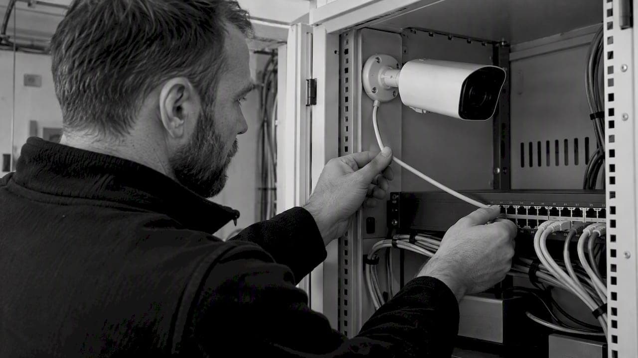
RTSP Security Risks: Integrators Must Block Exposed Ports 554 and 8554
See how integrators can reduce RTSP security risks: close exposed ports 554 and 8554, secure camera access, and verify each deployment with practical checks.
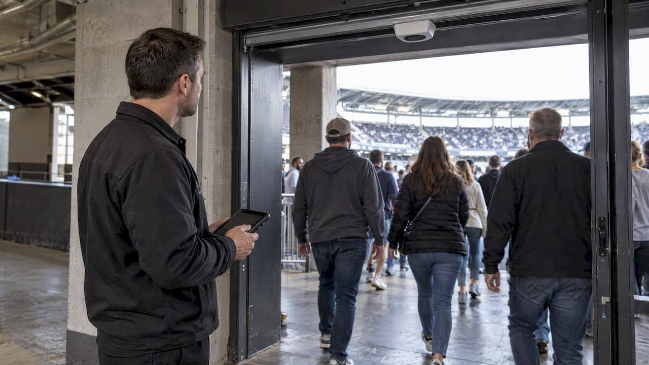
Require MAEpp and X Accuracy Before You Buy People Counting Systems
Verify people counting accuracy by demanding MAEpp, X Accuracy, and directional-bias reports. Validate on-site with at least 100 events per direction...
30–90 Day Pilot Validates Redundant Camera Networks for Engineers
Standards led, practical steps for engineers to deploy redundant camera networks: MRP, dual homing, and aggregation patterns, commissioning checks, and...
30 Day Pilot Proves Video Analytics Accuracy for Security Teams
Validate video analytics accuracy with scenario tests, camera tuning, transfer learning and a 30 day edge first pilot for security teams.
Let's Build YourSecurity Ecosystem.
Whether you're a System Integrator, Solution Provider, or an End-User looking for trusted advisory, our team is ready to help you navigate the BeyondSensor landscape.
Direct Advisory
Connect with our regional experts for tailored solutioning.